Strallegger Höllweg, Strallegg
Quiet tour above the flower village of Strallegg and refreshment stop at Jausenstation Posch.
The tour starts at 1,000 m above sea level at the Posch snack station. You walk pleasantly in the shade along idyllic forest paths.
Characteristics
Best season
January
February
March
April
May
June
July
August
September
October
November
December
The tour in numbers
easy
Level of difficulty
5,7 km
Route
1:50 h
Time
195 hm
Uphill
195 hm
Downhill
1052 m
Highest point
Map & downloads
More information
Strallegg is located in the East Styrian mountains. The municipal area rises from around 600 meters in the southwest to over 1000 meters.
By car:
From Graz: via the A2 (towards Vienna) to the Gleisdorf-West exit, follow the B54 to Weiz, then continue on the B72 towards Ratten, Strallegg
From Vienna: via the A2 (towards Graz) to the Gleisdorf-West exit, follow the B54 to Weiz, then continue on the B72 towards Ratten, Strallegg
Detailed information on how to get here can be found here .
- We hike from the Posch snack station following the yellow markings with no. 43. First in the direction of Angerkreuz where we turn right, from there it goes downhill into the "Höll"
- From here we walk along forest paths towards total tranquillity where you can enjoy nature and relax in some places
- We walk past the Holzeckkreuz-Parmakreuz to the cattle farms where you can enjoy a wonderful view
- After a short rest, we set off on the last section back to the Posch snack station
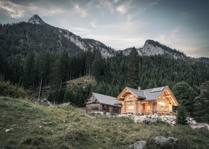
The Posch snack station, which is located directly on the route, takes care of your physical well-being.
Timetables and travel information can be found at Österreichische Bundesbahnen (ÖBB) or at Verkehrsauskunft Verbundlinie.
For local transportation we recommend the SAM-Sammeltaxi Oststeiermark.
Strallegg, Jausenstation Posch (free)
You can find information about the region, places to stop and stay overnight, excursion destinations, etc. here:
Eastern Styria Tourism Association
Joglland-Waldheimat office
8255 St. Jakob im Walde
Tel.: 03336/20255
info@joglland.at
www.joglland-waldheimat.at
Eastern Styria
current weather
Mobility Eastern Styria with shared taxi SAM
Wanderkarte Strallegg erhältlich im Gemeindeamt und DorfcafeGallery
1/5

Wayside chapel in Strallegg, Joglland-Waldheimat in Eastern Styria | © Oststeiermark Tourismus | Christine Pollhammer
2/5
_img_6513527 | © Oststeiermark Tourismus")
strallegger höllweg (hausstrecke posch)_img_6513527 | © Oststeiermark Tourismus | Sepp Reitbauer
3/5

Parish church of Strallegg, Joglland-Waldheimat in Eastern Styria | © Oststeiermark Tourismus | Christine Pollhammer
4/5

Above from Strallegg, Joglland-Waldheimat in Eastern Styria | © Oststeiermark Tourismus | Christine Pollhammer
5/5

Styrian Flower Road_Strallegg_Eastern Styria | © Gemeinde Strallegg
What the weather will be like
Strallegg (849m)
Morning

3°C
0%
5 km/h
Noon

7°C
0%
10 km/h
Night
4°C
0%
5 km/h
Morning clouds will clear gradually. Then frequent sunny periods.
Morning
3°C
15%
5 km/h
Noon
5°C
40%
5 km/h
Night

3°C
60%
5 km/h
Mostly cloudy with a few sunny spells. In the afternoon rain or snowfall will start.
26.02.2025
2°C
6°C
27.02.2025
1°C
5°C
28.02.2025
-1°C
6°C