Zeller Staritzen - round trip
Walking times:
- Crossing: 7 hours
- Kastenriegel - summit cross: 2 hours
Here you can find a blog report by Fred Lindmoser with many more pictures!
Characteristics
Best season
The tour in numbers
Map & downloads
More information
Coming from Bruck an der Mur in the direction of Mariazell - approx. 2 kilometers after the village of Gollrad on the left-hand side.
With the bus line 172 from Bruck an der Mur or Mariazell
If you want to go to the summit, go up to the right - in the direction of Zinken - over a stony steep slope and at the top continue over the meadow areas to the summit (1,619 m, magnificent panoramic view!) From the summit cross we descend in a southeasterly direction to the Hintere Staritzenhütte and then continue on the alpine road.
Shortly after, we turn right and follow the trail tracks downhill into a hollow. At the fence we go left on the footbridge further down through the forest to the forest road and follow this along to Kastenriegel. If you have the car at the bus stop, follow the forest road to the left and come out through the Ramer valley to the starting point at the bus stop.
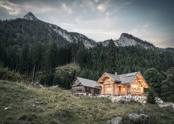
Sennhütte on the Hintere Staritze: managed approx. mid-June to mid-September
Main square 13, 8630 Mariazell
T: +43 (0) 3882 2366
You can get a hiking map free of charge in the office of the tourist officeGallery


 | © TV Hochsteiermark")
 | © TV Hochsteiermark")
 | © TV Hochsteiermark")


What the weather will be like
Mariazell (860m)