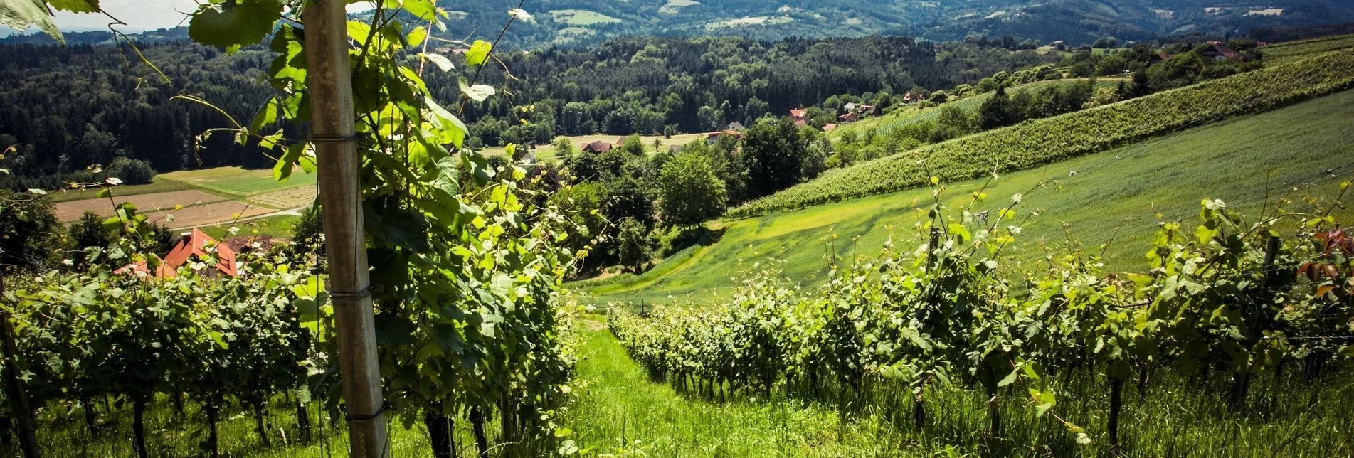

The Little Hochgrail Circuit
You wouldn't expect to find a chestnut plantation here, but that's precisely why you should stop off in autumn at the Wine and Chestnut Farm Klug vulgo Pletteri. Especially in autumn, it is a special treat to enjoy freshly roasted chestnuts and a glass of Schilchersturm or apple juice.
You can also take a souvenir photo with the legendary Archduke Johann and his Anna Plochl along the way. He resided here in the area in Stainz Castle, which is well worth a visit.
But there is one thing that belongs to hiking like Schilcher to the region: a hearty snack. A beetle bean salad with Styrian pumpkin seed oil is particularly recommended. A real treat. You will have plenty of opportunity for this at the numerous Buschenschänken (wine taverns) that you will pass along the way. Enjoy yourself here in the heart of Western Styria.
Characteristics
Best season
The tour in numbers
Map & downloads
More information
From the north: Motorway Munich - Salzburg - Eben - Schladming - Liezen onto the A9 towards Graz. Exit at Lieboch and follow the B76 towards Deutschlandsberg/Stainz. A9 is subject to toll - Gleinalmtunnel. Alternative: At St. Michael take the S6 towards Bruck and in Bruck take the S35 towards Graz. On the B76 in Schlieb turn right to St. Stefan ob Stainz until the next crossroads, turn left here after approx. 1.5km the car park is on the left.
From the west: In Villach take the A2 towards Klagenfurt. Take the Steinberg exit and drive in the direction of Stainz. In the village of St. Stefan ob Stainz turn left at the Stiegler Haus crossroads and after 50m you will find the car park on the right-hand side.
From the east: A2: Vienna - Aspang - Hartberg - Fürstenfeld - Graz. From Graz continue on the A2 in the direction of Klagenfurt and take the Lieboch exit in the direction of Stainz/Deutschlandsberg/Eibiswald. Follow the B76 to Deutschlandsberg/Stainz. On the B76 in Schlieb turn right to St. Stefan ob Stainz until the next crossroads, here turn left after approx. 1.5km the car park is on the left.
From the south: A1 from Marburg to Leibnitz. Exit in Leibnitz (Gralla) and continue on the B74 in the direction of Deutschlandsberg, take the second exit at the roundabout in Preding, after approx. 2km turn right onto the L617 in the direction of Stainz. In Stainz, drive through the town centre in the direction of Graz, and at the Spar-Markt crossroads turn left into St. Stefan. In the village of St. Stefan in the 30 km zone on the priority road at the church, cross the intersection and after 50 m you will have reached the car park on the right-hand side.
You start at the Schilcherland car park in St. Stefan ob Stainz. Here you leave your everyday life behind with the car and full of anticipation you set off. The hiking trail marked S10 leads you directly across the main square, but you will soon find yourself in a flowering meadow and wander through a forest until you reach a romantic ruined mill. You should linger a little at this special place and take a souvenir photo or two.
Afterwards, the path climbs slightly through the beautiful, quiet forest and you will soon see the first chestnut trees of the Klug chestnut farm, also called "Pletteri". The path leads you directly through the tree plantation to the farm. You must stop here and enjoy a glass of wine. When the chestnuts are ripe in autumn, you will experience a West Styrian classic for gourmets. Roasted chestnuts accompanied by a glass of Schilchersturm - a delight. Now you have arrived in the heart of Western Styria. Don't be sad if no one is home, there is a silent seller of drinks in the old cellar.
The view over the West Styrian vineyards is gorgeous from up here and makes another special photo motif. Just enjoy the moment and leave everyday life behind you.
Continue along the access road to Hochgrailstraße and from there turn left down to Buschenschank Hiden, vlg. "Höllerhansl". Time for a hearty snack and a refreshing spritzer.
Freshly invigorated, continue the hike down to the path marked S9. At the edge of the forest there is a unique opportunity for a souvenir photo with Archduke Johann and his beloved Anna Plochl. Through the forest, past the cemetery of St. Stefan, you return via the main square to the starting point.
The circle closes and you end a walk that will hopefully whet your appetite for more - for more culinary explorations through the home of the Schilcher.
With the BusBahnBim app of the Verbundlinie, timetable information is easier than ever: all connections by bus, train and tram in Austria can be retrieved by entering places and/or addresses, stops or important points. The app is available as a free app for smartphones (Android, iOS) - on Google Play and in the App Store.
Hauptplatz 40
A-8530 Deutschlandsberg
Tel +43 3462 7520
www.schilcherland.at
The hiking folder and the district-wide hiking map of Deutschlandsberg can be ordered free of charge online at www.schilcherland.at. ONLINE TOURS APPAll hiking tours can be found online at www.schilcherland.at/bewegung or via APP South & West Styria Tours in their app store.


