Celtic tree trail (Keltischer-Baumkreis-Weg)
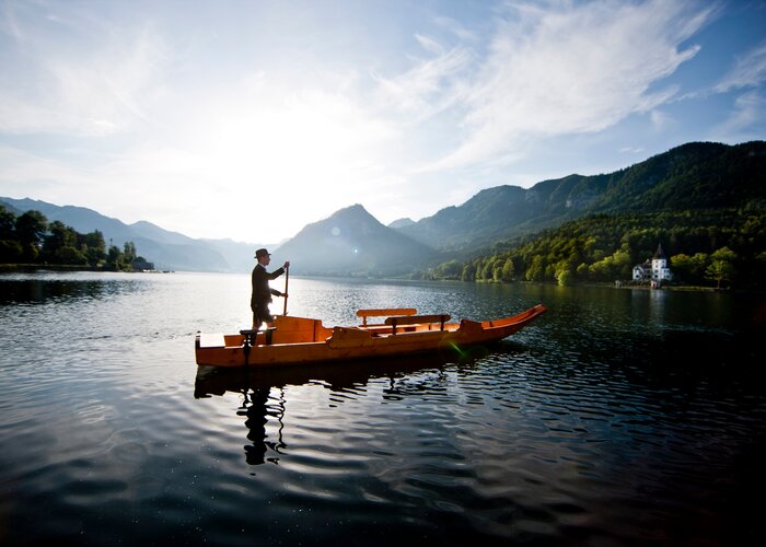
The starting point of the hiking tour is the information office in the center of Bad Waltersdorf. The 12.8 km long hiking tour leads along various trees, past traditional wine taverns and inns and the spa Bad Waltersdorf.
Characteristics
Best season
The tour in numbers
Map & downloads
More information
Only shortly after - approx. 100 m it goes right into the view tip: a short detour is worthwhile, because with the property of the family Pichler one has a marvelous view of the 2-Thermenregion Bad Waltersdorf.
After a short rest, return to the thermal road to the village pond of Wagerberg. Continue to Unterlimbach along a flat forest path. Arrived at the municipal office in Unterlimbach, turn right to the center of the village. There you go slightly downhill to a bridge. Crossing the bridge and turning left, you follow an asphalt path. To follow the edge of the forest to Oberlimbach, turn left and then right. Now you go slightly uphill to Wagerberg. In Wagerberg you cross a crossroads and enjoy the view over the 2-Thermenregion before you march downhill back to Bad Waltersdorf.
- Direction main crossing
- First over bridge and then right
- Cross the railroad-straight ahead to the Heiltherme and up the hill to Wagerberg
- cross the crossing past the village pond-along the flat gravelled forest path to Unterlimbach
- turn right at the pond
- turn left in the center of the village
- slightly downhill, over the bridge and then left into the forest
- follow the asphalted forest road, turn left at the next junction, then immediately right
- continue along the edge of the forest to Oberlimbach
- in the center of the village (crossroads) turn right to Wagerberg
- cross the crossroads in Wagerberg
- downhill back to Bad Waltersdorf to the information office
- GenussCard
- Pick up info brochure about the Celtic Tree Circle Trail at the info office Bad Waltersdorf
Detailed information about arriving by ÖBB (Austrian Federal Railways) can be found at www.oebb.at or on the Verbundlinie Steiermark website www.busbahnbim.at.
With Verbundlinie’s BusBahnBim route planner app, planning your journey has never been easier: simply enter towns and/or addresses, stop names or points of interest to check all bus, train and tram connections in Austria. The app is available free of charge for smartphones – on Google Play and in the App Store
Gästeinfo Bad Waltersdorf
Hauptplatz 90
8271 Bad Waltersdorf
Tel: +43 3382 55 100-71
badwaltersdorf@thermen-vulkanland.at
www.thermen-vulkanland.at
For hiking enthusiasts, the long-distance hiking trail "From Glacier to Wine" is a must. This hiking trail can be completed in stages and makes the heart of all nature lovers beat faster.
The Styria Tours app, which is available for free on Google Play and in the App Store (Android, iOS), offers detailed first-hand information: short facts (length, duration, difficulty, ascent and descent in altitude meters, ratings), map, trail descriptions, altimeter, compass, summit finder, navigation along the tour.
In addition, you can create your personal favorites list of favorite tours and points, save tours and destinations offline, play on social media channels and more.
Books about the history of the Celts and Romans are available for purchase at the Infobüro! Various hiking maps can also be found in the information office Bad Waltersdorf.Gallery


What the weather will be like
Bad Waltersdorf (291m)