


Von der Waldheimhütte nach St. Wolfgang
Characteristics
SkillThe tour in numbers
Level of difficulty
medium
Route
17,4 km
Time
5:00 h
Uphill
600 hm
Downhill
600 hm
Highest point
1612 m
“The Idyllic": On this leisurely hike, you can enjoy the beauty of nature, the fascination of the Granitzenbach natural monument and a refreshment stop at the idyllic Waldheimhütte and the stylish Seetalblick.
Park your car in the parking lot at the Waldheimhütte, then put on your hiking boots and off you go. Cross wonderful forests on fragrant forest paths until you reach the Granitzenbach stream. After a short “recharge your batteries” by the rippling waters, you can either turn around and hike back the way you came or take an enjoyable 3-kilometre loop through the idyllic village of St. Wolfgang. Here you can stop off at the Seetalblick restaurant and treat yourself to a delicious meal. At the end of the hike, we recommend a stop at the Waldheimhütte, which impresses with its charm and alpine flair.
Best season
January
February
March
April
May
June
July
August
September
October
November
December
More information
The Waldheimhütte is located at an altitude of 1,620 meters at the foot of the Zirbitzkogel and can be reached via a panoramic road.
Approach:
Via the B78 to the Obdacher Sattel:
Drive on the Obdacher Bundesstraße B78 to the top of the Obdacher Sattel pass.
Turn off in the direction of St. Anna / Zirbitzkogel:
At the Obdacher Sattel, turn off opposite the Wieser inn in the direction of St. Anna / Zirbitzkogel.
Continue to the Waldheimhütte:
Follow the road through the small mountain village of St. Anna. After St. Anna, the asphalt road turns into a well-maintained gravel road. Follow the signs for “Waldheimhütte” for about 6 kilometers on the winding gravel road.
The road ends at a large, paid parking lot near the Waldheimhütte.
There is a paid parking lot at the Waldheimhütte.
Approach:
Via the B78 to the Obdacher Sattel:
Drive on the Obdacher Bundesstraße B78 to the top of the Obdacher Sattel pass.
Turn off in the direction of St. Anna / Zirbitzkogel:
At the Obdacher Sattel, turn off opposite the Wieser inn in the direction of St. Anna / Zirbitzkogel.
Continue to the Waldheimhütte:
Follow the road through the small mountain village of St. Anna. After St. Anna, the asphalt road turns into a well-maintained gravel road. Follow the signs for “Waldheimhütte” for about 6 kilometers on the winding gravel road.
The road ends at a large, paid parking lot near the Waldheimhütte.
There is a paid parking lot at the Waldheimhütte.
Park your car at the Waldheimhütte. Follow the Herfried-Fuchs-Weg trail to the bridge over the Granitzenbach stream below the Bachsteiner farmstead. Here you follow the stream along the adventure trail to the access road to St. Wolfgang. Walk up this road to find the Herfried Fuchs trail back to the Waldheimhütte in the last bend before St. Wolfgang. You can also take in the Seetal view via a loop through St. Wolfgang.
- Backpack with rain cover
- Telescopic / hiking poles
- Mountain / hiking boots
- Gloves: waterproof and warming
- Headgear / sunglasses
- Outerwear: Onion layer system, T-shirt, sweater, jacket and winter jacket with hood
- Hiking pants
- Seat pad
- Drinking bottle / thermos flask (on cooler days a warming drink is pleasant)
- Snack
- First aid kit with blister plaster and tick tongs
- Route descriptionDetailed
- plan of the hike
- Hiking map: For overview a map in scale 1 : 50 000 of the respective region
- GPS device
- cell phone
Public transportation to Obdach is possible, but the Waldheimhütte is not accessible by public transportation
Map & downloads
Gallery

Obdach-Granitzenbach-c-AnitaFössl (3).jpg | © ANITA_FOESSL | ANITA_FOESSL
1/7

GranitzenbachSchaumühle-Ansicht6-Murtal-Steiermark | © Anita Fössl | Anita Fössl
2/7
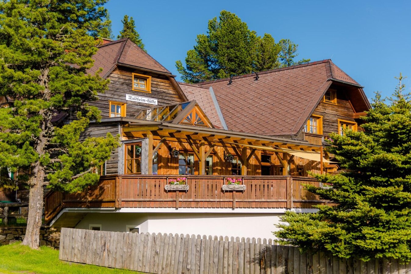
Waldheimhütte-Außenansicht-Murtal-Steiermark | © Waldheimhütte | Waldheimhütte
3/7

GranitzenbachSchaumühle-Logo1-Murtal-Steiermark | © Erlebnisregion Murtal | Erlebnisregion Murtal
4/7

Obdach-Granitzenbach-c-AnitaFössl (26).jpg | © ANITA_FOESSL | ANITA_FOESSL
5/7

Waldheimhütte-Gastzimmer3-Murtal-Steiermark | © www.spekner.com | Wolfgang Spekner
6/7

Waldheimhütte-Außenansicht4-Murtal-Steiermark | © www.spekner.com | Wolfgang Spekner
7/7

What the weather will be like Obdach (868m)
Today, 09.10.2026
The day will be dry, but mostly cloudy with occasional sunny spells.Morning

8°C
sr.Regenwahrscheinlichkeit
0%
sr.Windstärke
5 km/h
Noon

13°C
sr.Regenwahrscheinlichkeit
15%
sr.Windstärke
5 km/h
Night
10°C
sr.Regenwahrscheinlichkeit
15%
sr.Windstärke
5 km/h
Tomorrow, 10.10.2026
Mostly cloudy with occasional sunny spells. Light rain will start in the afternoon.Morning
8°C
sr.Regenwahrscheinlichkeit
5%
sr.Windstärke
5 km/h
Noon
14°C
sr.Regenwahrscheinlichkeit
45%
sr.Windstärke
5 km/h
Night

11°C
sr.Regenwahrscheinlichkeit
65%
sr.Windstärke
5 km/h
Forecast
11.10.2026

7°C
15°C
12.10.2026
4°C
14°C
13.10.2026

3°C
16°C
