
"Geotrail Grundlsee"
Accessible by public transportCharacteristics
SkillThe tour in numbers
Easy hike along the southern shore from Grundlsee to the legendary Toplitzsee. 34 exciting stations provide information about the geological features of the region. Ideal for families and those with a thirst for knowledge. Optional boat trip to Kammersee possible. Return journey on foot, by boat, or by bus.
Best season
More information
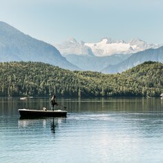
The Grundlsee Geotrail is a fascinating, easy-to-walk themed trail that offers exciting insights into the geological development of the Ausseerland region. This approximately ten-kilometer hike runs along the southern shore of the lake to Lake Toplitz without any significant inclines, making it ideal for anyone who wants to combine nature, education, and relaxation.
The Geotrail starts on the western edge of Grundlsee and follows the hiking trail along the southern shore. A total of 34 marked information stations provide exciting insights into the formation of the Alps, explain geological formations, and reveal hidden landscape phenomena—including glacier traces, moraines, old rockfalls, and karst springs.
Shortly after station 20, at the mouth of the Stimitzbach stream, you can continue the hike across the Gößlerwiese meadow directly to Lake Toplitz. The route runs at the foot of the imposing Gößler Wand, whose striking rock formations impressively document the interplay of limestone and the forces of erosion.
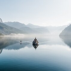
The Geotrail ends at Lake Toplitz, known for its mysterious history and emerald green water. From here, you can take a boat trip to Lake Kammersee – the source of the Traun, one of the most important rivers in the Salzkammergut.
You can return to the starting point either on foot via the same route or conveniently by scheduled boat or regional bus.
Tip: Can be divided into stages
Those who prefer to hike in two stages can also divide the Geotrail. The first half stretches from Grundlsee to station 20 at Stimitzbach. From there, an alternative return route leads across the Gößlerwiese back to the Gößl terminus. This variant is particularly suitable for family hikes in the Ausseerland region.
Hiking in Ausseerland means not only exercising in beautiful natural surroundings, but also immersing yourself in a region steeped in geological and cultural history. The Grundlsee Geotrail is a successful example of nature trails that bring knowledge to life while encouraging exercise and relaxation.
For optimal tour planning, the free Ausseerland hiking map is available free of charge on the tourism association's website when ordering brochures. Detailed map material is also available in the hiking map shop.
Information office Grundlsee
Mosern 25
8993 Grundlsee
+43 3622 86 66
Send e-mail
Website
Hiking maps are available at the information offices in Ausseerland. The brochure to the GEO TRAIL is available in the tourism office in Grundlsee.


